The River Witham weaves around Lincolnshire, passing through towns, villages and seemingly endless countryside. You can walk or cycle all the way along its banks from Lincoln to Boston on a scenic 53-kilometre route known as the Water Rail Way. Rather than brave the whole distance, we decided to try one section at a time! First up, we dipped our toes in with the opening five kilometres from Lincoln to the charming village of Washingborough, where an old pub with a sunlit beer garden awaits. Here’s our quick guide to the Lincoln to Washingborough walk, rounded off with lunch at the Ferry Boat.
The Water Rail Way: a quick background
Many moons ago, Lincoln and Boston were connected by a direct railway line that traced along the meandering pathway of the River Witham. The line was opened in 1848 and was operational for over a century before eventually closing in the 1960s. It was full of life in its heyday, as railway and boat operators competed fiercely for cargo and passengers.
As often happens with disused railways, the line fell into abandon and deterioration for many years after closing. But in the early 2000s, a new idea emerged to transform the route into a resource for local communities and create an attraction for tourists. A new walking and cycling path was built on the old railway route, forming part of the National Cycle Network.
A local competition was held to name the new Lincoln-to-Boston route. ‘Water Rail Way’ was chosen in recognition of its former use, and also as a nod to the abundant wildlife on the trail. The water rail is one of many bird species that live along the banks of the Witham.
After an investment of £2 million and four years of construction, the route opened fully in 2008. It is dotted with artworks and sculptures, many inspired by the portfolio of legendary Lincolnshire-born artist Alfred Lord Tennyson.
The route passes by various quaint rural villages and small towns that are at the heart of life in Lincolnshire, such as Barndey, Southrey and Woodhall Spa. We begin our discovery of the route here with the first leg, between Lincoln and Washingborough.

Where to start the Lincoln to Washingborough walk
The River Witham flows through Lincoln city centre. You can begin the Water Rail Way trail pretty much anywhere on the river by following it eastwards out of the city.
We picked it up from the High Street, where the river flows underneath Stokes High Bridge Café. You can’t go wrong if you just stick to the south side of the river here and keep going.
The official beginning of the route begins around Stamp End, to the east of the city centre, where there is plenty of parking around the river. A pathway along the riverside begins from the car park outside the Lincs FM building at Waterside South.
In total, the Lincoln to Washingborough walk is roughly four or five kilometres depending on where you start. It takes about an hour at a steady pace.

Things to look out for along the route
As you walk along the route, which is flat and gentle the entire way, you will pass information signs and plaques that tell stories about the history of the area.
We found the first of these underneath the River Witham Bridge coming out of Lincoln. You probably wouldn’t guess that this seemingly plain old railway bridge had such architectural significance! Built in Victorian times during the initial construction of the railway, it incorporated an advanced design that helped to pave the way for modern steel bridges.
Sir John Fowler, who spearheaded the project, was later the lead engineer in the construction of the Forth Bridge in Scotland, considered one of the world’s greatest feats of engineering.
Keep your eyes peeled for artwork as the trail continues. One of these is ‘the Stump’, a colourful wooden viewing platform in the earliest stages of the trail. Further along you will also pass a sundial.
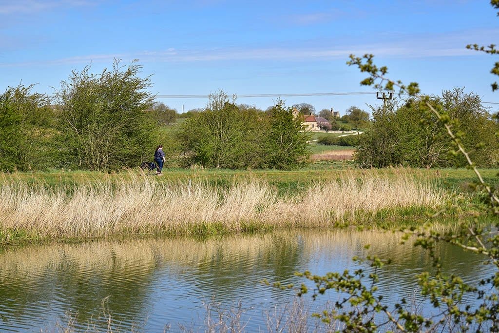
As you emerge into open countryside, look out for wildlife in the woodlands and fields around the riverside. We saw some colourful butterflies and birds. You also may encounter some Lincoln red cattle, curly coat pigs and longwool sheep.

Between the River Witham and Sincil Dyke
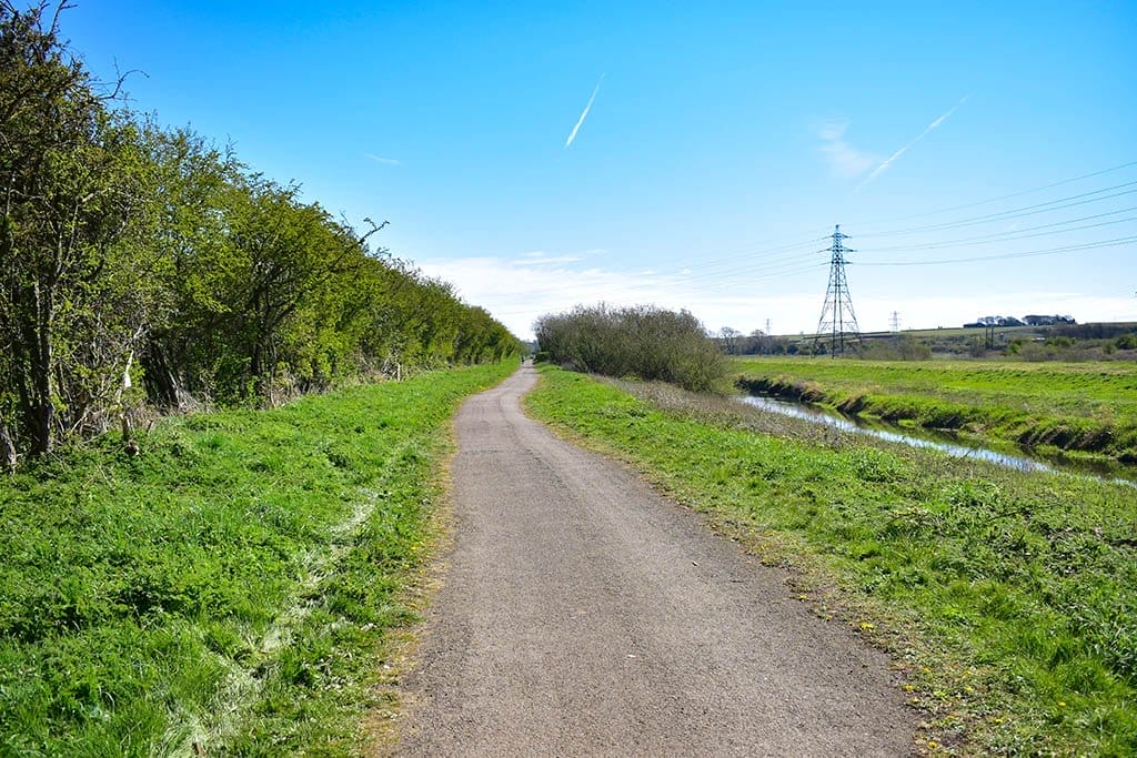
On this stretch of the Water Rail Way between Lincoln and Washingborough, the path runs between the River Witham and Sincil Dyke, a smaller waterway that was used as a drainage channel in medieval times.
For much of the first section the path is open on the right-hand side, with views of the fields and trees beyond Sincil Dyke, while the Witham is hidden away by trees on the left.
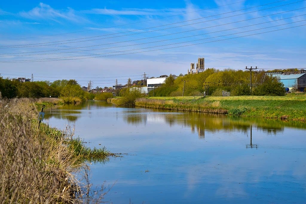
In various places, small beaten pathways lead off to the left onto viewing spots on the River Witham bank. Looking back towards the city from here you can see Lincoln Cathedral reflecting onto the water.

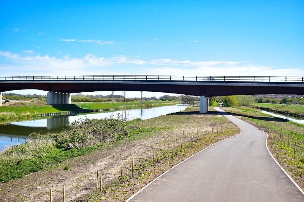
Under the Lincoln Eastern Bypass
When you reach the Lincoln Eastern Bypass, you’re approximately halfway to Washingborough. The path opens out here as it passes under the bridge with some lovely views of the river landscape, before becoming encapsulated by woodland again. Look back again here for another nice view of the cathedral.
As you get closer to Washingborough, you may spot a pretty stone building just across from the fields to the north of the river. This is All Saints Church in Greetwell, which dates back to the 11th century and was restored in 1855–56.
Arriving in Washingborough
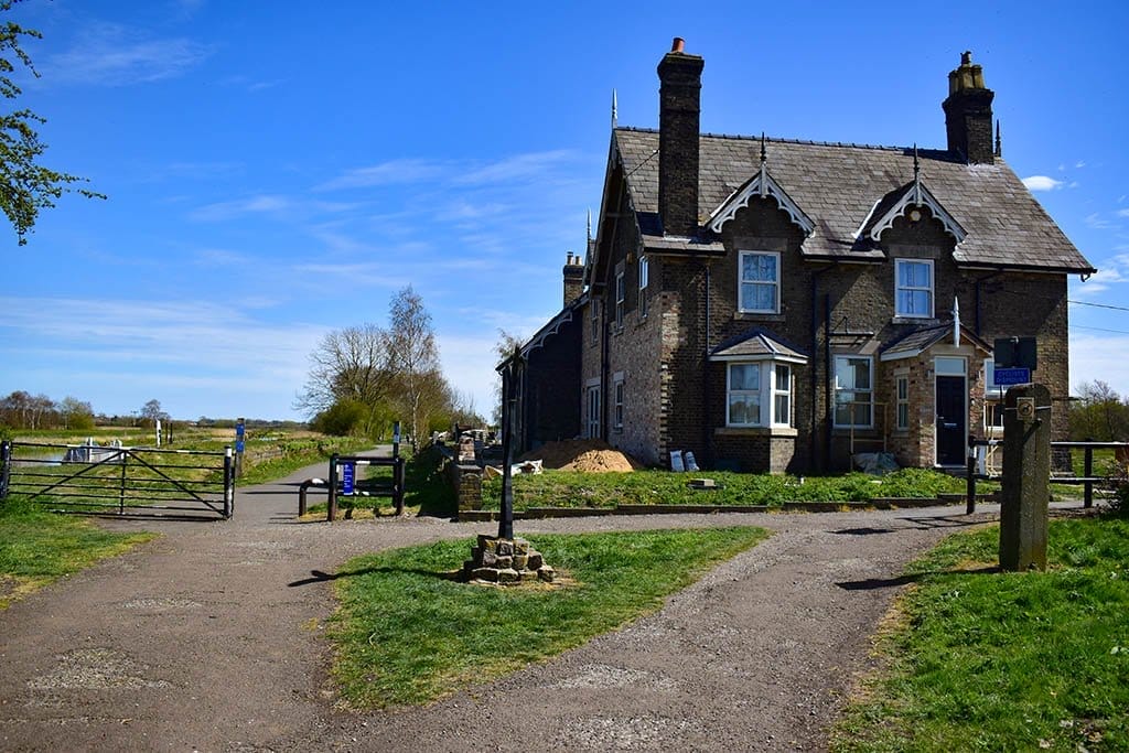
Eventually you will meet a large building on the right of the path. This is the old Station House that served the Washingborough station on the old railway. A sign on the left here tells you that you’ve come 2.5 miles from Lincoln.
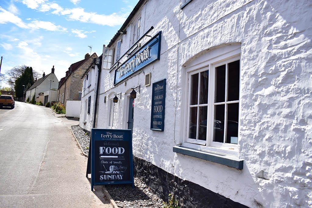
Ready for a pub lunch? Take the path to the right away from the river, which leads into Washingborough village. Turn left when you reach the Main Road, walk along it for 300 yards or so, then take a right up Washingborough High Street. The pub is on your right.
Lunch at the Ferry Boat
The Ferry Boat is a characterful 17th-century pub with an ample beer garden that gets plenty of sunlight. It serves hearty traditional English pub fare – think pies, burgers, fish and chips. Just what we needed after a walk along the river in the sunshine.
Try one of the desserts too – you can always walk it off on the trail back to Lincoln!
Check out our full review of the Ferry Boat Washington to find out more.
Map of the Lincoln to Washingborough walk
Here’s the map view of the Water Rail Way trail first section from Lincoln to Washingborough:
We will continue to walk sections of the Water Rail Way and write about the route – next up will be Washingborough to Bardney! This will eventually culminate in a guide to the full trail.
For more trails in the area, check out our rundown of some of the best walks in Lincoln.
For activity ideas at either end of the Water Rail Way trail, see our articles on things to do in Lincoln and things to do in Boston.
Have you done the Lincoln to Washingborough walk on the Water Rail Way? Let us know what you thought about it in the comments below.
Love this? Pin it for later!