The Lincolnshire Wolds are spread across one of the most scenic regions of the English countryside. Covering over 500 square kilometres of rolling low hills and flat fens, intermitted with old market towns and quaint villages, this Area of Outstanding Natural Beauty is woven with various walking and cycling routes for you to discover its nature and history. On a spring Saturday we tried the Lindsey Trail north route, a 16-kilometre loop walk that encompasses the villages of Walesby and Tealby, and passes through the peaceful Willingham Woods. Here’s our guide to the trail and what to look out for along the way.
What is the Lindsey Trail north route?
The Lindsey Trail is one of the longest and best-established walking routes in the Lincolnshire Wolds. In its entirety it spans from Market Rasen in the north of the region down to Horncastle in the south.
The full Lindsey Trail is around 111 kilometres, about two thirds of which is along countryside roads, and the rest on gentle paths through woodlands and fields. The easy terrain makes it a pleasant route to try by either foot or bicycle.
The north route of the Lindsay Trail is a circuit that loops 16 kilometres around the northernmost part of the full trail. Passing close to the town of Market Rasen, it meanders through Walesby, Tealby and Willingham Woods, taking in lots of forest and open countryside in between.
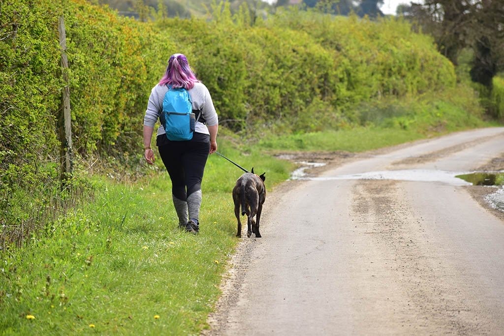
We brought the dog along with us for the walk. It’s the longest distance he had done with us yet, but he wasn’t fazed! It was a lovely walk to do with him – we just needed to be careful on the sections of main road. But in the quiet of the countryside we could always hear when cars were coming.
Where to start the Lindsey Trail north route
As the Lindsey Trail north route is a circular trail, you can start and finish pretty much anywhere around its circuit. Market Rasen is the main town in the vicinity. If you’re coming from Lincoln, it’s an easy half-hour drive to here up the A46.
The official and most convenient starting point for the Lindsey Trail north route is at the Willingham Woods Bikers Meeting Place on the A631, where there is a car park and café.

We began a little further up at Walesby Woodlands Caravan Park, as this is where we were staying for a camping weekend. The trail passes right next to this quiet countryside campsite.
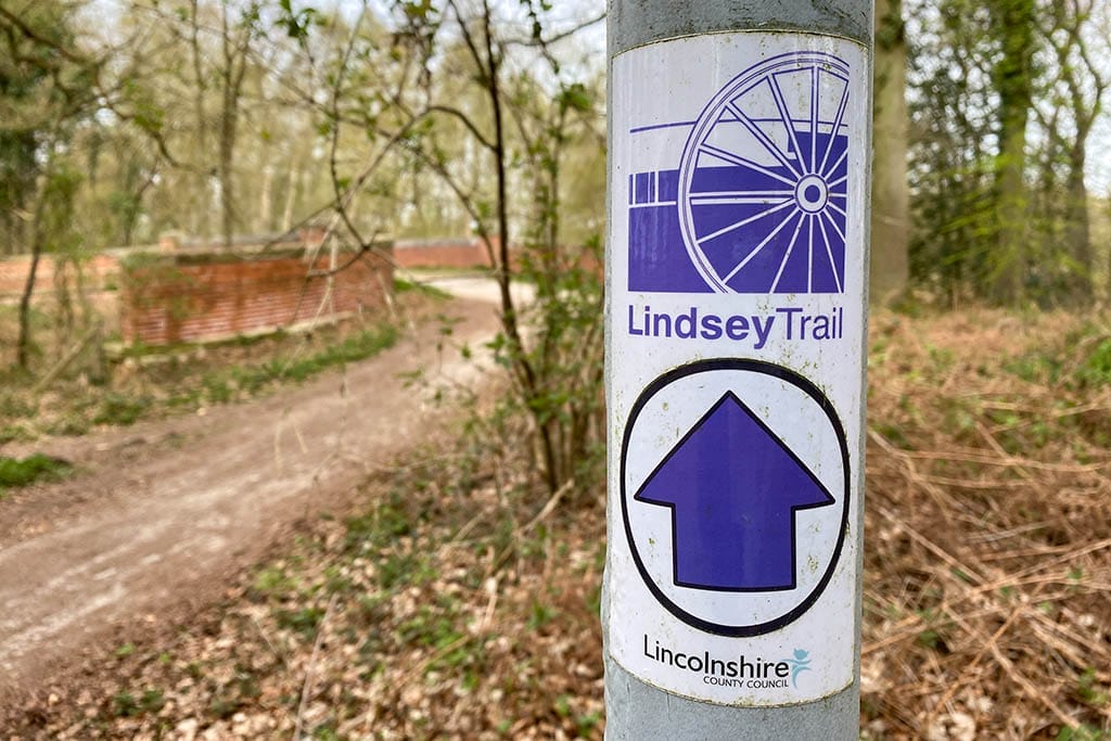
All the way around the trail there are signposts marking the Lindsey Trail with purple colour coding, so it’s not too difficult to stay on track.
From the Bikers Meeting Point the trail leads north into Willingham Woods, where the well-marked path is surrounded each side by tall pine trees. Eventually the trail emerges onto Tealby Road (the B1203).
Turn left here and follow the road for about half a kilometre, then right onto a public byway at the Sunnyside Up farm shop. The path continues into some woods and soon passes Walesby Woodlands Caravan Park.

Passing through Walesby
After the caravan park the path continues into Walesby Moor, surrounded by sleepy woodland, and eventually joins a railway line, tracing alongside it to the left-hand side.
The path emerges onto Moor Road, a quiet country lane, where you turn right, immediately cross a level crossing, then continue towards Walesby.
Walking alongside the road on this stretch we loved the views across the farmlands and flowery fields. Looking up to the left you can spot the National Air Traffic System radar dome at Wolds Top, the highest point in the Lincolnshire Wolds.


Three kilometres or so along this road leads you into Walesby. It’s a cosy, quiet village typical of many around the Lincolnshire Wolds.
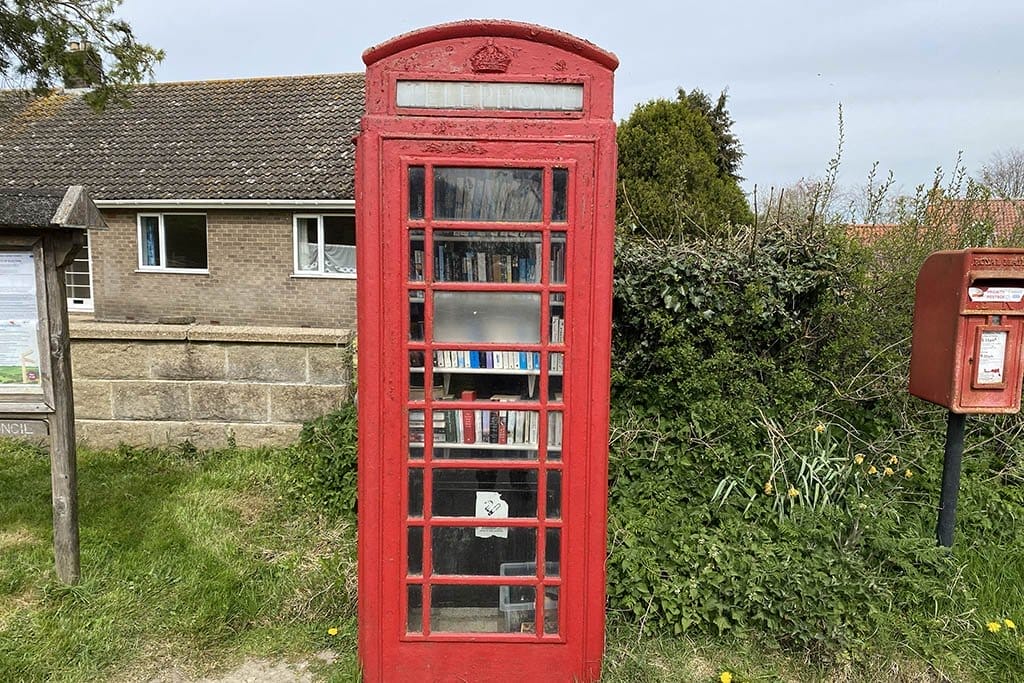
Turn right at Walesby Village Hall, then immediately right again, and you will soon reach St Mary’s Church. There’s also an old red post box that has been converted into a miniature library. Then turn left onto Catskin Lane, signposted towards Tealby and North Willingham.
A lunch stop in Tealby
The section from Walesby to Tealby is around four kilometres and took us an hour or so. There are some gorgeous views to the right here across sprawling farmland.
Hills rise up above the road to the left, and in a sloping field we spotted a herd of deer of some kind. We haven’t been able to figure out the exact breed, but they were some of the biggest deer we’ve seen in the UK! Can you tell from this photo?


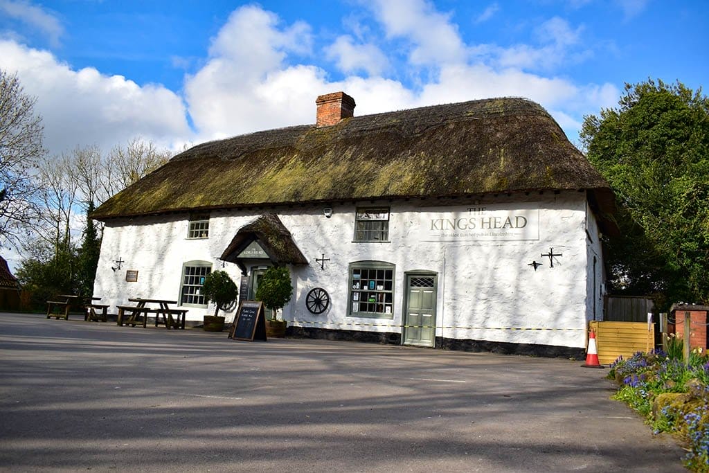
Tealby is one of Lincolnshire’s prettiest little villages. What’s more, it is situated perfectly half-way around the trail for a stop-off. We paused for lunch here at the Kings Head, which is Lincolnshire’s oldest thatched pub, full of countryside village charm.
The food was fabulous, with a menu of traditional pub classics made with fresh local produce, washed down with a real ale in the sunshine. Resting our feet for a while in the lovely beer garden was just what we needed after the morning’s walk! Read our full review of the Kings Head Tealby for more about this experience.
The Olde Barn is another pub in Tealby that serves food, and The Vintage Tearooms is another option. We might try these out next time, although it will be hard to say no to returning to the Kings Head!
Wandering through Willingham Woods
The route heads south out of Tealby on Sandy Lane through a stretch of open countryside. The road proceeds through cultivated farmlands with impressive views across the Wolds in all directions.

A couple of kilometres south of Tealby the road reaches the A631, where you turn right. This is a busier road which you need to walk along for a few hundred metres before crossing and taking a left onto a path that leads into woods.
The final section of the trail weaves around Willingham Woods and its towering pine trees. There are a few good spots here to stop for a picnic or snack in a forest opening, or on random logs at the side of the path.
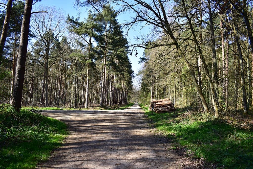
Keep an eye out for the Lindsey Trail signs to stay on the route. After leaving the A631 the path is straight for a while with some fields to your left, before it loops right into the woods.
Eventually you turn right again, doubling back towards the A631. After taking another left and right turn, you will arrive once again at the A631, this time at the Willingham Woods Bikers Meeting Place car park, back at the beginning.
Lindsey Trail north route map
You can view and download a map of the Lindsey Trail north route on the Lincolnshire County Council website. We found that we only needed to refer to this a few times along the way, but it did help to keep us on track when we were unsure.
Where to stay for the Lindsey Trail north route
Walesby Woodlands Caravan Park is the perfect spot on the trail to stay if you want a camping or caravanning weekend.
If you’d prefer to stay under a roof, there are several other options nearby. The town of Market Rasen is just a couple of miles from the trailhead. Take a look at our guide to the best hotels in Market Rasen and other places to stay in the area.
Have you walked any sections of the Lindsey Trail? Let us know about it in the comments below.
Love this? Pin it for later!